Vintage French Educational School Map Poster Asia Geography 20082617
Couldn't load pickup availability
French School Map Poster Asia
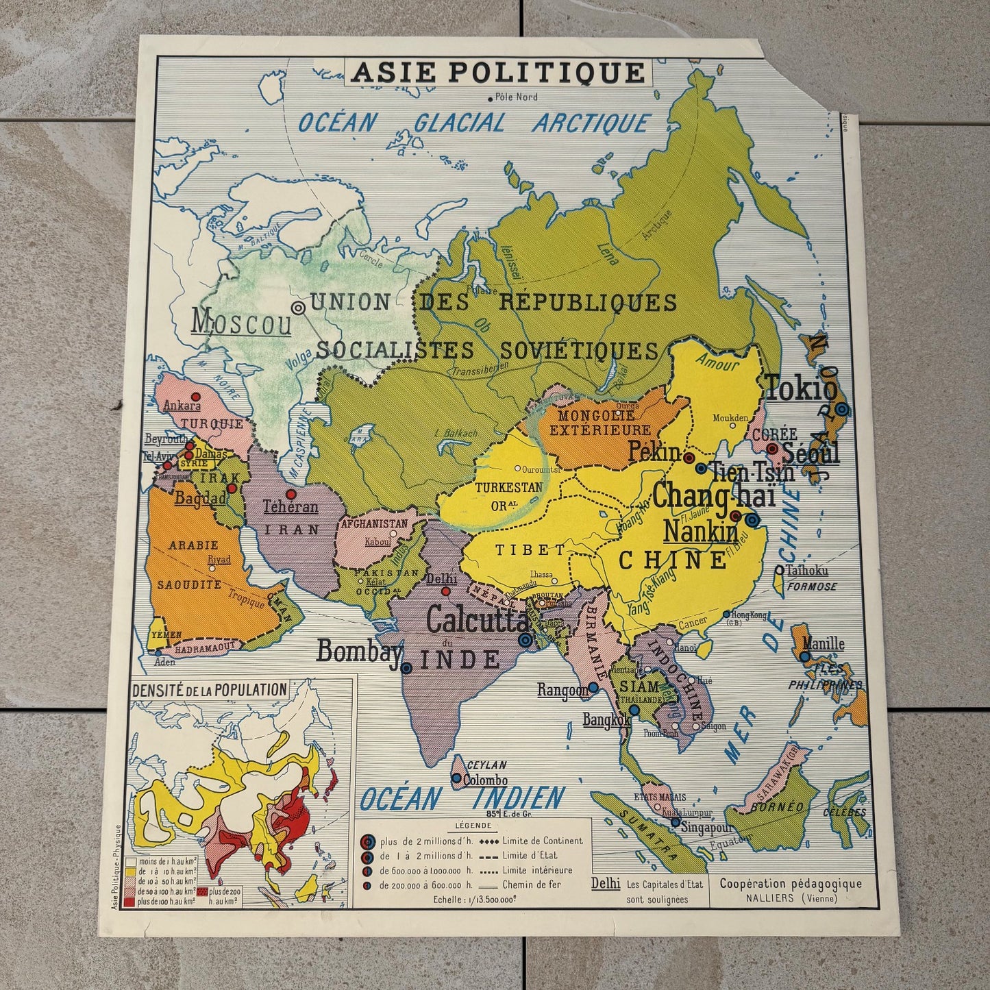
A double-sided French school map poster Asia, produced by Cooperation Pedagogique Nalliers (Vienne), a well-known French educational publisher that supplied classroom wall charts throughout the mid-20th century. One side presents "Asie Physique" (Physical Asia) with topographic shading, mountain ranges, rivers and a climate inset map; the reverse carries "Asie Politique" (Political Asia) showing national borders, capitals and a population density inset. The political side labels the USSR as "Union des Republiques Socialistes Sovietiques," placing production firmly in the Cold War era, most likely the 1950s or early 1960s.
The physical map uses layered brown and ochre shading to indicate elevation zones, with a clear legend ranging from sea level to above 2000m. Blue ink marks rivers and coastlines throughout. Major features labeled include the Himalaya, Tibet, the Pamir, Tian-Chan, Hindou-Kouch and the rivers Ob, Yenissei, Lena and Amour. The political map is printed in a multicolor scheme with green, orange, amber yellow and rose tones distinguishing territories. Cities such as Pekin, Chang-Hai, Calcutta, Bombay, Tokio and Seoul are marked with dot symbols scaled by population. Both sides show the characteristic bold black typography and clean cartographic style typical of mid-century French pedagogical print production. The paper is mounted on a stiff backing sheet. General condition is good with age-consistent toning and minor handling wear at edges; no tears or significant losses are visible in the photos.
The poster measures approximately 90cm x 75cm / 35.4" x 29.5". This is a large-format wall chart intended for classroom display.
A practical decorative piece for a library, study or office, and a collectible reference for enthusiasts of vintage cartography, Cold War history or mid-century French print culture. The double-sided format adds reference value, offering both physical geography and the political world as it was mapped in the 1950s.
95% of my items are tariff-free to the US.
Share
Shipping
Shipping
Shipping time may vary depending on the destination country and the package (small/large) but it is usually 2/3 weeks.
All items are shipped from France with tracking number.