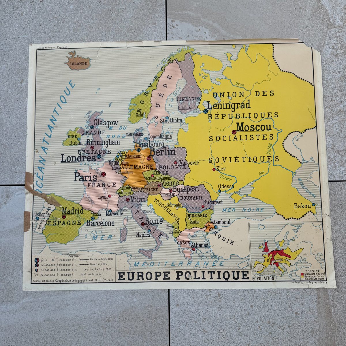
Vintage French Double-Sided School Map Europe Physique Politique 11112610
Couldn't load pickup availability
French school map Europe double-sided
A double-sided French school map of Europe, printed on heavy paper and published by Cooperation Pedagogique Nalliers of Vienne, France -- a name legible in the lower left corner of each face. One side presents Europe Physique: a handsome physical geography chart mapping mountain ranges from the Alpes and Pyrenees to the Carpates and Caucase, major rivers including the Volga and Danube, and the Grande Plaine Europeenne, all rendered in a warm palette of ochre and terracotta elevations against pale blue seas. Flip it over and Europe Politique appears, country borders drawn in soft gold, rose and sage, with capitals and major cities plotted by population class, and the vast yellow expanse of the Union des Republiques Socialistes Sovietiques occupying the east -- a vivid reminder of mid-20th-century European geopolitics.
These cartes murales, the wall maps that hung in every French schoolroom from the postwar decades onward, have become genuinely sought-after graphic objects. The bold black lettering, the confident cartographic hand and the inset climate and population diagrams give each side its own graphic presence. Framed or mounted on a wooden batten in the traditional way, this map works equally well in a library, a home office or a hallway that calls for something with intellectual character.
Condition and patina consistent with age. Some light toning and minor creasing to the paper, with a small brown stain visible at the lower right corner on the physical side -- all well within the expected wear of a working classroom map.
Approx. 35.4 in wide x 29.5 in high (90 x 75 cm).
95% of my items are tariff-free to the US.
Share
Shipping
Shipping
Shipping time may vary depending on the destination country and the package (small/large) but it is usually 2/3 weeks.
All items are shipped from France with tracking number.